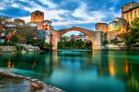
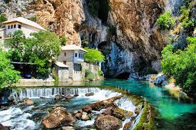
Discover Bosnia and Herzegovina, a unique crossroad of ancient civilizations with a mixture of both Western and Eastern influences. Start your trip in the capital of Sarajevo, with a guided walking tour of its historic center, followed by a hike to the Highland Villages in the Bjelašnica Mountains, including Gradina and Umoljani with views of the Rakitnica Canyon. End your tour in the 15th-century city of Mostar and the neighboring settlement of Blagaj, where youll enjoy exploring Buna Spring and its neighboring Ottoman house and monastery.

Geography
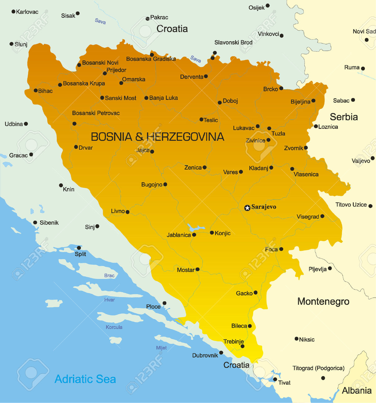
Bosnia and Herzegovina is located in Southeastern Europe, in the western Balkans. It has a 932 km border with Croatia to the north and southwest, a 357 km border with Serbia to the east, and a 249 km border with Montenegro to the southeast. It borders the Adriatic Sea along its 20 km (12.42 mi) coastline.
The most striking features of the local terrain are valleys and mountains which measure up to 2386 m in height. The country is mostly mountainous, encompassing the central Dinaric Alps. The northeastern parts reach into the Pannonian basin, while in the south it borders the Adriatic sea.
The countrys name comes from the two regions Bosnia and Herzegovina, which have a very vaguely defined border between them. Bosnia occupies the northern areas which are roughly four fifths of the entire country, while Herzegovina occupies the rest in the southern part of the country.
The major cities are the capital Sarajevo, Banja Luka in the northwest region known as Bosanska Krajina, Bijeljina and Tuzla in the northeast, Zenica and Doboj in the central part of Bosnia and Mostar, the capital of Herzegovina.
The south part of Bosnia has Mediterranean climate and a great deal of agriculture. Central Bosnia is the most mountainous part of Bosnia featuring prominent mountains Vlašić, Čvrsnica, and Prenj. Eastern Bosnia also features mountains like Trebević, Jahorina, Igman, Bjelašnica and Treskavica. It was here that the 1984 Winter Olympics were held.
Eastern Bosnia is heavily forested along the river Drina, and overall close to 50% of Bosnia and Herzegovina is forested. Most forest areas are in Central, Eastern and Western parts of Bosnia. Northern Bosnia contains very fertile agricultural land along the river Sava and the corresponding area is heavily farmed. This farmland is a part of the Parapannonian Plain stretching into neighbouring Croatia and Serbia. The river Sava and corresponding Posavina river basin hold the cities of Brčko, Bosanski Šamac, Bosanski Brod and Bosanska Gradiška.
The northwest part of Bosnia is called Bosanska Krajina and holds the cities of Banja Luka, Prijedor, Sanski Most, Jajce, Cazin, Velika Kladuša and Bihać. Kozara National Park and Mrakovica World War II monument is located in this region.
The country has only 20 kilometres (12.4 mi) of coastline,[2] around the town of Neum in the Herzegovina-Neretva Canton, although surrounded by Croatian peninsulas it is possible to get to the middle of the Adriatic from Neum. By United Nations law, Bosnia has a right of passage to the outer sea. Neum has many hotels and is an important tourism destination.
Various archaeological artifacts including relicts of mining activities and tools belonging to similar age groups, provide an indication of the geographical distribution, scale and methods of mining activities in Bosnia and Herzegovina during the Paleolithic to Roman era.
Most important of these is the so-called area of “central Bosnian mountains” located between the rivers Vrbas, Lašva, Neretva, Rama and their tributaries. The second one is the area of western Bosnia, bordered by the Vrbas and Una rivers, with its main orebearing formations found in the river-valleys of Sana and Japra, and their tributaries. The third area is eastern Bosnia, around the river Drina between the towns of Foča and Zvornik, the principal mining activity centered around Srebrenica.
Ores of various metals, including iron, are found in these areas and exploitation has been going on for more than 5000 years – from the period of prehistoric human settlers, thorugh Illyrian, Roman, Slavic, Turkish and Austrian rulers, into the present.
Population
Islam 49%
Serbian Orthodox 34%
Roman Catholic 14%
other 3%
Transport
Roadways
total: 21,846 km
• paved: 11,425 km (4,686 km of interurban roads)
• unpaved: 10,421 km (2006)
Railways
• Total: 1032
Standard gauge: 1032 km 1,435 mm (4 ft 8 1⁄2 in) (2006)
Rail links with adjacent countries[edit]
• Same gauge: 1,435 mm (4 ft 8 1⁄2 in)
• Croatia - yes
• Serbia - yes
• Montenegro – no
Airport
Airports - with paved runways
total: 7
2,438 to 3,047 m: 4
1,524 to 2,437 m: 1
under 914 m: 2 (2008)
Airports - with unpaved runways
total: 18
1,524 to 2,437 m: 1
914 to 1,523 m: 7
under 914 m: 10 (2008)
Greetings
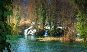
Sights


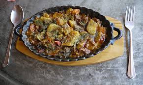
Cuisine


Posters
Map
Itineraries
| Sr. No. | Itinerary Name | File |
Our Websites