Geography
Belarus, a landlocked, generally flat country (the average elevation is 162 meters (531 ft) above sea level) without natural borders, occupies an area of 207,600 square kilometers (80,200 sq mi), or slightly smaller than the United Kingdom or the state of Kansas. Its neighbours are Russia to the east and northeast, Latviato the north, Lithuania to the northwest, Poland to the west, and Ukraine to the south. Its extension from North to South is 560 km (350 mi), from west to east is 650 km (400 mi)
Belaruss mostly level terrain is broken up by the Belarusian Range (Byelaruskaya Hrada), a swathe of elevated territory, composed of individual highlands, that runs diagonally through the country from west-southwest to east-northeast. Its highest point is the 346-meter (1,135 ft) Mount Dzyarzhynskaya, named for Felix Dzerzhinsky, head of Cheka. Northern Belarus has hilly landscape with many lakes and gently sloping ridges created by glacial debris. In the south, about one-third of the republics territory around the Pripiac River is taken up by the low-lying swampy plain of Palyessye, shared with Ukraine, Poland and Russia.
Glacial scouring accounts for the flatness of Belarusian terrain and for its numerous lakes.
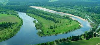
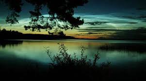
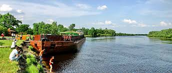
Belaruss 3,000 streams and 4,000 lakes are major features of the landscape and are used for floating timber, shipping, and power generation. Major rivers are the west-flowing Western Dvina and Nyoman rivers, and the south-flowing Dniapro River with its tributaries, Berezina River, Sozh, and Prypyat rivers. The Prypyat River has served as a bridge between the Dnepr flowing to Ukraine and the Vistula in Poland since the period of Kievan Rus. Lake Narach, the countrys largest lake, covers eighty square kilometers.
Nearly one-third of the country is covered with pushchas, large unpopulated tracts of forests. In the north, conifers predominate in forests that also include birchand alder; farther south, other deciduous trees grow. The Belavezhskaya Pushcha (shared with Poland) in the far west is the oldest and most magnificent of the forests; a reservation here shelters animals and birds that became extinct elsewhere long ago.
Because of the proximity of the Baltic Sea (257 kilometers or 160 miles at the closest point), the country has temperate continental climate. Winters last between 105 and 145 days, and summers last up to 150 days. The average temperature in January is −6 °C (21 °F), and the average temperature for July is about 18 °C (64 °F), with high humidity. Average annual precipitation ranges from 550 to 700 millimeters (21.7 to 27.6 in) and is sometimes excessive.
Population
Belarusian 83.7%,
Russian 8.3%,
Polish 3.1%,
Ukrainian 1.7%,
other 2.4%,
unspecified 0.9% (2009 est.)
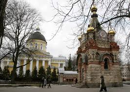
Eastern Orthodox 80%,
other (including Roman 20% (1997 est.)
Catholic, Protestant,
Jewish, and Muslim)
9,608,058
Transport
Railway
Rail transport in Belarus is operated by Belarusskaya Chyhunka
total: 5,512 kilometres (3,425 mi)
country comparison to the world: 32
broad gauge: 5,497 km (3,416 mi) of 1,520 mm (4 ft 11 27⁄32 in) gauge (874 km (543 mi) electrified) (2006)
City with underground railway system: Minsk, see Minsk Metro
For tramway systems: see List of town tramway systems in Belarus
Highways
The owners of highways may be the Republic of Belarus, its political subdivisions, legal and natural persons, who own roads, as well as legal entities, which roads are fixed on the basis of economic or operational management.
Republican state administration in the field of roads and road activity is the Department Belavtodor under the Ministry of Transport and Communications of the Republic of Belarus.
In total, in Belarus there are more than 93,000 km (57,800 mi) of roads and 200 km (120 mi) of departmental thousand (agriculture, industry, forestry, etc.), including 16,000 km (10,000 mi) in cities and towns. The density of paved roads has been relatively low – 337 km per 1,000 km2 territory – for comparison, in European countries with well-developed road network, the figure is an average of 906 km (563 mi).
total: 93,055 km (57,822 mi)
paved: 93,055 km (57,822 mi) (2003)
Airport
Minsk International Airport
Minsk-1
Gomel Airport
Airports - with paved runways[edit]
Main article: List of airports in Belarus
total: 35
over 3,047 m (10,000 ft): 2
2,438 to 3,047 m (8,000 to 10,000 ft): 22
1,524 to 2,437 m (5,000 to 8,000 ft): 4
914 to 1,524 m (3,000 to 5,000 ft): 1
under 914 m (3,000 ft): 6 (2008)
Airports - with unpaved runways[edit]
total: 30
2,438 to 3,047 m (8,000 to 10,000 ft): 1
1,524 to 2,437 m (5,000 to 8,000 ft): 1
914 to 1,523 m (3,000 to 5,000 ft): 2
under 914 m (3,000 ft): 26 (2008)
Greetings
Sights


Cuisine


Posters
Map

Itineraries
| Sr. No. | Itinerary Name | File |
| 1 | Minsk | View Itinerary |
Our Websites