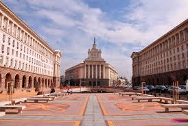
Geography
The most notable topographical features are the Danubian Plain, the Balkan Mountains, the Thracian Plain, and the Rhodope Mountains. The southern edge of the Danubian Plain slopes upward into the foothills of the Balkans, while the Danube defines the border with Romania. The Thracian Plain is roughly triangular, beginning southeast of Sofia and broadening as it reaches the Black Sea coast. The Balkan mountains run laterally through the middle of the country. The mountainous southwest of the country has two alpine ranges—Rila and Pirin, which border the lower but more extensive Rhodope Mountains to the east. Bulgaria is home to the highest point of the Balkan peninsula, Musala, at 2,925 metres (9,596 ft) and its lowest point is sea level.
Population
Transport
A mode of transport is a solution that makes use of a particular type of vehicle, infrastructure and operation. The transport of a person or of cargo may involve one mode or several of the modes, with the latter case being called intermodal or multimodal transport. Each mode has its own advantages and disadvantages, and will be chosen for a trip on the basis of cost, capability, and route.
Railway: Rail transport is where a train runs along a set of two parallel steel rails, known as a railway or railroad. The rails are anchored perpendicular to ties (or sleepers) of timber, concrete or steel, to maintain a consistent distance apart, or gauge. The rails and perpendicular beams are placed on a foundation made of concrete, or compressed earth and gravel in a bed of ballast. Alternative methods include monorail and maglev.
Highway: The most common road vehicle is the automobile; a wheeled passenger vehicle that carries its own motor. Other users of roads include buses, trucks, motorcycles, bicycles and pedestrians. As of 2010, there were 1.015 billion automobiles worldwide. Road transport offers a complete freedom to road users to transfer the vehicle from one lane to the other and from one road to another according to the need and convenience.
Air: Two things necessary for aircraft are air flow over the wings for lift and an area for landing. The majority of aircraft also need an airport with the infrastructure to receive maintenance, restocking, refueling and for the loading and unloading of crew, cargo and passengers. While the vast majority of aircraft land and take off on land, some are capable of take off and landing on ice, snow and calm water.
Greetings
Sights
Cuisine
Posters
Map
Itineraries
| Sr. No. | Itinerary Name | File |
| 1 | 2015_BEACH_CRICKET 4N-5D Packages | View Itinerary |
| 2 | 2015_SOFIA_PLOVDIV_3N-4D Packages | View Itinerary |
| 3 | 2015_THE_BEST_OF BULGARIA 5N-6D Packages | View Itinerary |


